Showing posts with label map project. Show all posts

Monday, June 18, 2012

Map Project #2: Pictorial Travel History

My daughter informed me I have left my readers hanging. Apparently I promised to post the second map project I made for her. Sorry for the lapse. I got so caught up in my aqua painting madness that I didn't follow through on that very quickly. (I know, I also still need to do that monkey's fist tutorial I promised. I'd better just keep promises to a minimum in the future, hadn't I? In my defense, my promise on the maps was "sometime soon". It has only been slightly over a week. That falls within "sometime soon", right?


In order to keep from getting too far behind, here comes Map Project #2 - Highlighting the Good Ole US of A and Cally's travels to places in the Eastern half of the country, (as of the time when I made this.)


Since I had two big laminated maps, one of the USA and one of the World, I had to choose one to cut into squares, as we saw in the first project, the Map Mosaic, and one that would highlight Cally's travels using images from various trips.


Cally had traveled some parts of Europe at the time, but because the countries on the World Map are so small, that map didn't work for the kind of picture project I wanted to do, so I chose the map of the USA. Plus, I had the photos from her USA travels at my disposal, and since this was a surprise, I needed to gather the pictures in stealth mode as much as possible.


If you want to create something like this, you'll need:


A canvas (they can be pricey so check for sales and store coupons. I got mine for 50% off!)
A map (I used a laminated one)
Spray adhesive
Resized images from your travels (preferably printed at a photo center.)


None of the canvases I found were the same size as the the map, but it so happened that the bordered area of this map fit pretty well within one of the available sizes, so all that was needed was to cut the map along those lines. The excess would have detracted anyway.


When working with spray adhesive, be prepared to align the map carefully and work out any bubbles that form. Some stretching may occur and you will likely need to trim edges.


The time consuming part of this project is the effort you'll spend scouring your photo albums and computer files for full-length images. Full-length is preferable, as far as I was concerned because they appear more grounded, instead of looking like heads and partial bodies floating aimlessly across the country or the water. I like to get in close when I take pictures, so it wasn't easy for me to come up with distant images that included whole bodies. I did the best I could with as many as I could.
I copied and resized the photos I'd chosen into a document and printed a draft of the page on my own printer just to check the sizes before having the final pages printed from a cd at my favorite camera shop. I went ahead and included some extra images. They were not all needed, but since I was printing them at a photo center, I wanted to have everything possible on hand when I started cutting and working the images onto the map. That way I wouldn't have to go back again in the middle of the project if I changed my mind about any of them. After cutting the printed images out, they were laid out in the appropriate cities on the map to see how they'd fit.


Luckily for me, tedious cutting tasks are right up my alley, especially when it comes to pictures. I found it fun to reminisce as I worked with the photos, and it was satisfying...especially when the project came together.


Ta da! Little people everywhere!


With some double-sided tape cut into eensy weensy pieces, the images were secured onto the map. Tweezers came in very handy.

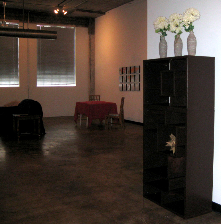
After all that, do you think I ever got a good shot of the map on a wall anywhere? Here it is (in part) adorning another of Cally's living spaces. The shot of it on the loft wall had glare across it, so I didn't want to use that one. I was not intending this as any sort of blog post at the time, hence I didn't think to take appropriate images. I hope you get the idea.

Remember that ink jet images generally fade, and often quite quickly, especially in rooms with a lot of light. So for this type of project, it really does work best to take your images on a cd in jpg format (or another picture format) to a photo center for printing.

There you have it. We can also add images to our map as time goes on and as Cally continues to travel and keep a growing pictorial history. Sweet!

I hope you go on now and have some fun with maps yourself! 

I'll be sharing this project at:


Tuesday To Do Party

Saturday, June 09, 2012

Map Project #1: Mosaic Map

Here's a little map project I did for Cally a couple of years back when she was moving into the loft in Birmingham.


When I went looking for laminated maps, I found they came two to a package, a world map and a map of the USA, so I decided to use them both and make her two separate map creations. She was fond of maps at the time, so it worked out fine.


For the world map, I chose to break it up and attach pieces of the map to canvas squares with spray adhesive, creating a mosaic effect. Target had the canvas squares in their dollar section at the time, a sweet score since I needed 15 of them. 

The squares were spray painted black so the edges looked finished and so they would have a shadowy effect once each section of the map was attached. 

Unfortunately I have been unable to locate any pictures of the spray painting mess anywhere. I'm sure you can imagine the scene just fine.
What a croc...me with the measuring tape trying so hard. Why I attempted spacial mathematics, I don't know. I always get it wrong. (is that even a thing?) There were many times I had to go ahead and eyeball it and make a second or third hole in the wall because the placement as measured didn't look right. Me and math aren't the best of friends. Whatever... perfection is overrated.

You get the idea. The added space between the squares made the display about 6 or so inches wider and taller. Every bit was helpful (although still not sufficient really) on the massive wall, and made it a bit more interesting than just hanging a map by itself.


Doing a map project does help with your geography, especially if you, like me, are not only mathematically challenged but geographically challenged. It took a while when I first laid the finished squares out at home to realize I had switched the bottom portions of South America and Africa.


I guess I was on map overload at the time because it's quite obvious now.

Duh! This way makes for a very short South America and very long Africa. 


Working out the perfect cut of each piece was a bit of a challenge, because they had to fit the particular canvas. They each had some differences and were not square. Small amounts of map had to be trimmed from some, but thanks to the gap between the sections, once placed on the wall, it wasn't noticeable. After each was placed ever so carefully on the canvas so that it fit correctly, the bubbles had to be smoothed out.

Here's how the map ended up looking on the loft wall in all it's enormity. It sure lost some of its punch in such a huge space 


Sorry for the poor, blurry, grainy shot. By the time we were done, it was dark in there. 
I have another map project I'll post sometime soon. Stay tuned.

I'll be sharing this post at:

Too Much Time On My Hands